
Key Points
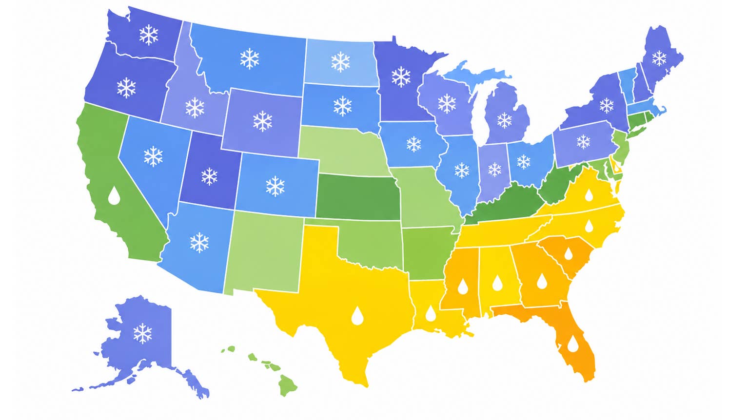
- On the maps NOAA issued Aug. 20, three western areas pair above-normal precipitation with a temperature forecast that does not lean warm, the combination snow needs.
- Coastal California is the biggest shift in the package, reversing the dry lean NOAA carried across the central West a month ago.
- Colorado's traction rules for those corridors come back into force Sept. 1.
Federal forecasters put out their updated seasonal maps today, Aug. 20, and a few places come out of them with the snow odds stacked better than anywhere else in the country. They are not where most of the wet ink sits, either. They are, however, the same corridors where traction rules and chain controls return for the season, with Colorado’s taking effect in two weeks.
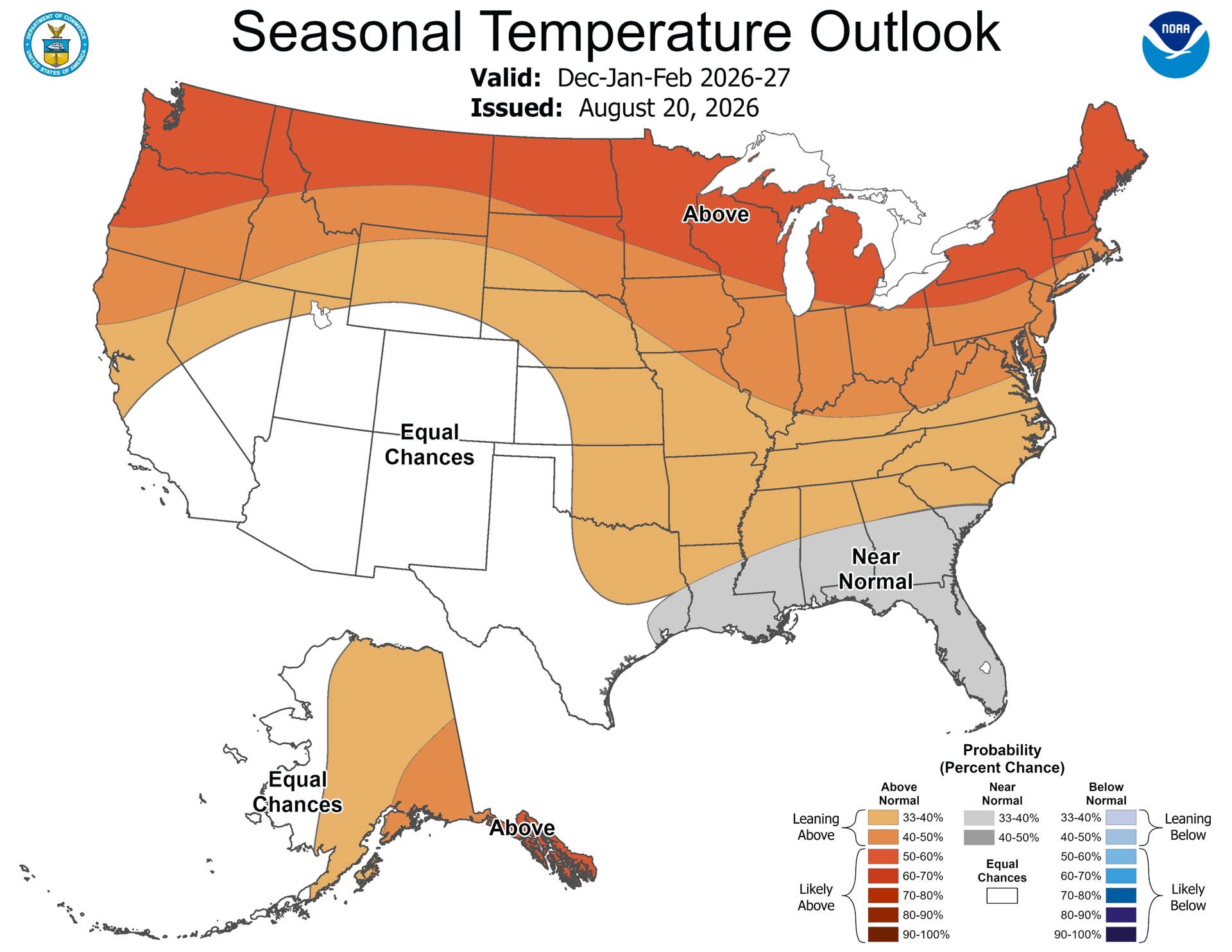
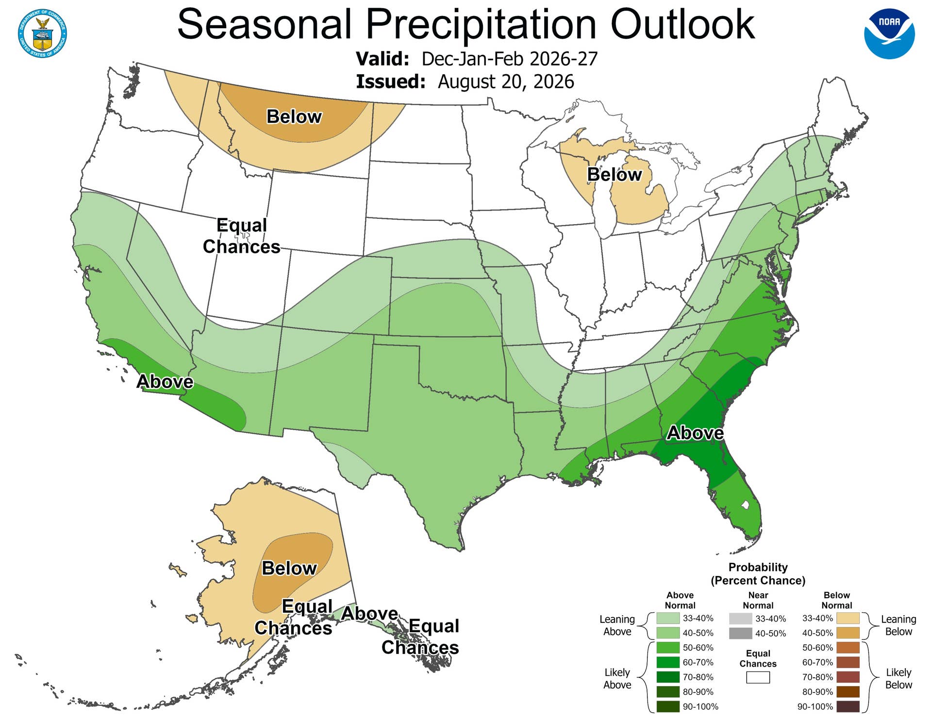
NOAA never issues a snow map. It issues two, one for precipitation and one for temperature, and snow needs both of them to line up. The wet forecast this year covers a huge area, but the temperature forecast runs warm over most of that area, which means a lot of the precipitation is going to arrive as rain. Take those places out and what remains is a much smaller group.
Which States Are in Line for More Snow?
Three areas stand out, and the Southwest is the broadest of them. Arizona, New Mexico and adjacent corners of Nevada and Utah are inside the wet area on the December through February maps here, and the temperature version assigns them no lean in either direction, the Equal Chances label NOAA uses when the odds of a warm, cold or average season are roughly even. Southern Colorado and the southern Rockies make the second group on the same basis, with altitude doing the rest of the work.
NOAA/Climate Prediction Center
NOAA/Climate Prediction Center
California is the third, and it is the biggest change in the package. Precipitation odds along the coast now exceed 50 percent, and the wet area widens further into late winter. The late-winter maps here show it pushing well inland, reversing the dry lean NOAA had across the central West a month ago. Whether any of it arrives as snow depends entirely on altitude. The Sierra passes are a different climate from the coast highway.
The three areas, and what each map says about them:
| Area | Precip, Dec to Feb | Temp, Dec to Feb | Corridor |
| Southwest: Arizona, New Mexico, adjacent Nevada and Utah | Above normal | Equal Chances | I-40, I-17, US-550 |
| Southern Colorado and the southern Rockies | Above normal | Equal Chances | I-70 between Dotsero and Morrison |
| California, precipitation odds above 50 percent along the coast and expanding inland by March | Above normal | Leans warm | I-80 and US-50 over the Sierra passes |
Montana, Idaho and the northern High Plains go the other way, drawing the only dry tilt in the West.
Timing is its own variable. NOAA’s forecasters expect the southern signal to build slowly before ramping up in the core winter months and especially late winter, because the closest historical matches to this El Nino point to a delayed onset. The early-winter maps here carry a weaker version of the same pattern, which means a quiet December would not tell you much about January.
So the snow story this year is largely a mountain story, and every one of those corridors comes with rules that switch on before the first storm does.
Which Rules Are Actually in Force?
Colorado’s is the one with a date on it. The Traction Law returns Sept. 1 and runs through May 31 on the I-70 stretch between Dotsero and Morrison, and the state can switch it on for any highway when conditions call for it. Under the rules as CDOT states them here, AWD and 4WD vehicles must have qualifying winter, all-weather or mud-and-snow tires with at least 3/16 inch of tread. Anything less means chains or an approved traction device. Noncompliance runs $100 plus a $33 surcharge, and if it ends up closing a travel lane the figure jumps to $500 plus a $157 surcharge.
That 3/16 works out to 6/32, three times the 2/32 tread depth commonly used as the legal replacement threshold for passenger tires. Colorado wants that much before it will let a car up the mountain.
California runs on conditions rather than the calendar, with three levels of chain control deciding what you need. R1 exempts passenger vehicles under 6,000 pounds gross weight with snow tires on at least two drive wheels. R2 narrows that to four-wheel and all-wheel drive with snow-tread tires on all four corners. R3 exempts nobody. Either way the chains have to be in the car, signs go up about a mile ahead of the checkpoint, and the speed limit inside a control drops to 25 or 30 mph.
The takeaway is the same on both sides of the Rockies. A tire that satisfies the law where you live may not satisfy the law where the snow is.
None of this amounts to a snowfall total, and NOAA never produces one. Whether a storm drops eight inches or an inch of slush comes down to the day itself. What the maps give you is a sense of where to place the bet, and Sept. 1 is the part already fixed.
About the author

Adam Lynton
Co-Editor-in-Chief, Autoblog